
Getting Downtown
Downtown London Map
Click here to download the Downtown London Business Improvement Area Boundary Map!

Walking or Cycling?
The City of London has put together a handy map indicating the best walking trails and cycling lanes. The bike & walk maps are produced to help cyclists, walkers and hikers navigate the city with ease. They are popular resources for both residents and tourists. They help Londoners and visitors build a sustainable city and strengthen our community.
Public Transit
Every major transit route runs through downtown for your convenience!
All LTC conventional service routes are now designated “Accessible”. This means that every scheduled bus on each route will be a low-floor accessible bus. The low floor bus creates greater opportunity for access to regular transit for many more people. Our Operators are trained to recognize the need for, offer and provide assistance when necessary within the boarding and securement areas of the bus.

Parking Options
Did you know?
- From York Street to Queens Ave and from Ridout to Wellington, on-street metered parking is FREE after 6pm Monday to Friday.
- On-street metered parking is FREE for 2 hours on Saturdays.
- On-street metered parking is FREE ALL DAY on Sundays.
- There are 40 parking lots downtown — not including street parking spaces!
- You can buy a monthly pass through Impark, Citi Plaza, or Precise Parking.
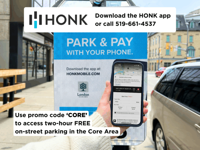
Free two-hour complimentary parking using HONK:
To support local businesses, free two-hour on-street parking for the Core Area is now being offered using the HONK app. Check to make sure the HONK promo code sticker is shown on the on-street or master meter and then enter the code CORE under "Add Promo" at time of checkout.